The role of meteorological monitoring in early warning of soil erosion
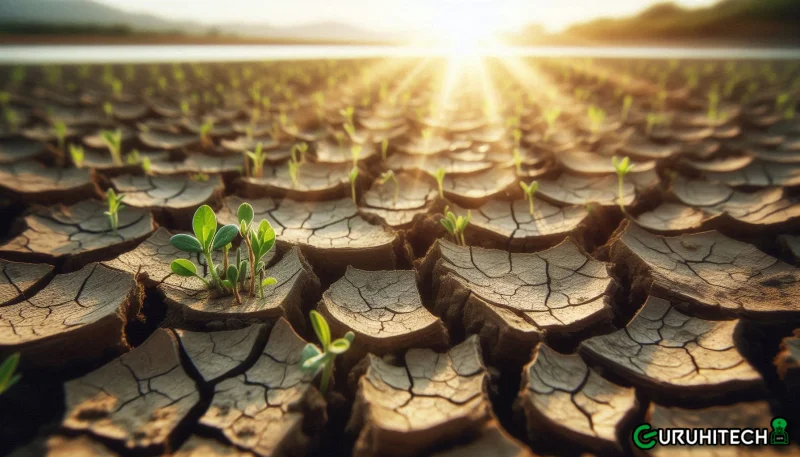
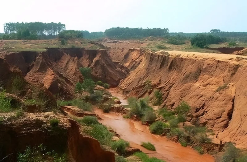
In the context of many challenges facing the global ecological environment today, soil erosion, as a serious environmental problem, has received widespread attention. Soil erosion not only leads to a decline in soil fertility and land productivity, but also triggers natural disasters such as mudslides and landslides, posing a huge threat to human life and property safety and ecological balance. Meteorological monitoring plays a vital role in early warning of soil erosion.
Provide precipitation data
Among all the factors that lead to soil erosion, precipitation is undoubtedly one of the most critical factors. In the natural environment, precipitation is an important part of the water resource cycle, but when the intensity and pattern of precipitation are abnormal, it may become the culprit of soil erosion.
For example: heavy rain pours down in a short period of time, which will rapidly increase surface runoff. A large amount of rainwater quickly gathers on the ground, with a strong scouring force, which can easily carry away soil particles, thereby accelerating soil erosion. Although the intensity of long-term rainfall may not be as strong as that of heavy rain, the continuous soaking and scouring of the soil will also make the soil structure loose and more easily carried away by water.
The meteorological monitoring system plays an irreplaceable role in dealing with this potential threat. Rain gauges installed in different areas can collect precipitation data in real time. Professional meteorologists will conduct in-depth analysis of these data and predict heavy rainfall events that may cause soil erosion through complex algorithms and models. For example, in some mountainous areas, the terrain is complex and the ecological environment is fragile. Once heavy rainfall occurs, it is easy to cause disasters such as landslides and mudslides. The meteorological monitoring system can detect the trend of heavy rainfall in advance and provide early warning information to local residents and relevant departments, so that they have enough time to take preventive measures, such as evacuating residents in dangerous areas and strengthening protective projects on hillsides.
Monitoring wind speed and wind direction
Wind speed and wind direction are also important meteorological factors affecting soil erosion, which are profoundly reflected in different geographical environments. In the vast arid areas, the land lacks effective protection of vegetation and the soil is exposed to the harsh natural environment. When strong winds blow, tiny soil particles are swept into the air, forming dust and sand that drifts in all directions. This wind erosion can lead to serious land degradation over time, making the already poor land even more barren and unable to support vegetation growth and agricultural development.
Meteorological monitoring stations are usually equipped with anemometers and wind vanes to monitor wind conditions in real time. Anemometers can accurately sense wind speed, while wind vanes always indicate the direction of the wind. These data are essential for assessing wind erosion risks and formulating corresponding preventive measures. For example, in some areas where sandstorms are rampant, local governments can plant windbreaks in a targeted manner based on wind speed and direction data provided by meteorological monitoring stations. At the same time, these data can also help the agricultural sector adjust the planting layout of crops and avoid planting crops that are vulnerable to sandstorms in areas with high wind erosion risks.
Analyzing temperature changes
Temperature changes are an extremely complex and subtle factor in the entire ecosystem. They have a direct and far-reaching impact on soil structure and vegetation growth, and are closely related to the occurrence of soil erosion. From a microscopic perspective, soil is a complex structure composed of various minerals, organic matter, water and air. Temperature fluctuations can cause changes in the water content of the soil. For example, in cold winters, when the temperature drops below freezing, the water content in the soil freezes. As the temperature rises and falls repeatedly, the soil undergoes freeze-thaw cycles. Ice generates expansion and contraction forces during its formation and melting, which are sufficient to destroy the aggregate structure of the soil, making the originally compact soil loose and brittle. Once the soil structure is destroyed, it is more susceptible to rain and wind erosion, thereby increasing the risk of erosion.
In terms of vegetation growth, temperature plays an even more decisive role. Different plants have different ranges of adaptation to temperature, and too high or too low temperatures will affect the growth and development of plants. For example, in some high-altitude areas or cold northern regions, low temperatures may limit the growing season of plants and reduce vegetation coverage. The roots of vegetation can firmly grasp the soil and prevent soil erosion. When vegetation grows poorly due to unsuitable temperatures, the soil loses the protection of vegetation, and the risk of soil erosion will be greatly increased.
Temperature data recorded by meteorological monitoring systems can help researchers gain a deeper understanding of these complex processes. By analyzing temperature data over many years, researchers can find out the patterns of temperature changes and predict potential soil erosion events. For example, in some mountainous areas, if abnormal fluctuations in winter temperatures are predicted, which may lead to more freeze-thaw cycles, relevant departments can take measures in advance, such as laying protective nets on the hillsides to reduce soil loss during freeze-thaw.
Supporting early warning models
The data provided by meteorological monitoring is an important input to the soil erosion early warning model. Under the framework of modern science and technology, the soil erosion early warning model is a highly complex and comprehensive tool that attempts to predict the possibility and intensity of soil erosion by integrating multiple data such as meteorology, topography, and soil type. Meteorological data occupies a core position in this model because meteorological factors are one of the direct driving forces of soil erosion.
For example, remote sensing monitoring technology, as a powerful space observation method, combined with meteorological data, can realize dynamic monitoring and early warning of soil erosion. Remote sensing satellites can obtain surface information over a large area, including vegetation coverage, soil moisture, etc. When these remote sensing data are combined with precipitation, temperature, wind speed and other data obtained from meteorological monitoring, a more comprehensive and accurate soil erosion warning model can be constructed. This model can analyze which areas are more prone to soil erosion under specific meteorological conditions based on the specific conditions of different regions.
For example, in some areas with sparse vegetation, loose soil texture and concentrated precipitation, the warning model can predict that the risk of soil erosion in these areas is extremely high during heavy rain. Such prediction results can provide important decision-making basis for land management departments. They can reasonably plan land use methods based on warning information, such as restricting reclamation in high-risk areas and strengthening vegetation restoration projects.
Meteorological monitoring plays an indispensable role in soil erosion warning. It not only provides key environmental data, but also helps managers identify and respond to potential soil erosion risks in advance through advanced data analysis and intelligent warning systems. With the continuous development of technology, meteorological monitoring will play an increasingly important role in soil erosion warning and management in the future.
Ti potrebbe interessare:
Segui guruhitech su:
- Google News: bit.ly/gurugooglenews
- Telegram: t.me/guruhitech
- X (Twitter): x.com/guruhitech1
- Bluesky: bsky.app/profile/guruhitech.bsky.social
- GETTR: gettr.com/user/guruhitech
- Rumble: rumble.com/user/guruhitech
- VKontakte: vk.com/guruhitech
- MeWe: mewe.com/i/guruhitech
- Skype: live:.cid.d4cf3836b772da8a
- WhatsApp: bit.ly/whatsappguruhitech
Esprimi il tuo parere!
Ti è stato utile questo articolo? Lascia un commento nell’apposita sezione che trovi più in basso e se ti va, iscriviti alla newsletter.
Per qualsiasi domanda, informazione o assistenza nel mondo della tecnologia, puoi inviare una email all’indirizzo [email protected].
Scopri di più da GuruHiTech
Abbonati per ricevere gli ultimi articoli inviati alla tua e-mail.